
Satellite Map और Khasra Boundary को सही तरीके से कैसे समझें?
WebGIS satellite map MP — imagery vs Khasra boundary alignment
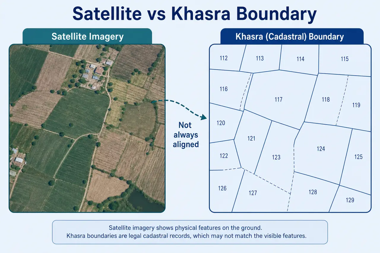
WebGIS पर satellite base layer और Khasra parcel overlay एक साथ दिखाई देती हैं, लेकिन दोनों का purpose अलग है। Users अक्सर सोचते हैं कि boundary line field edge, building wall या road edge से perfectly match करनी चाहिए।
Minor visual shift common हो सकता है। यह guide satellite imagery, Khasra boundary, alignment mismatch और safe comparison workflow को practical भाषा में समझाती है।
Layer controls समझने के लिए WebGIS Khasra overlay and layers guide देखें। यह page satellite imagery और Khasra boundary comparison पर focused है।
महत्वपूर्ण सूचना: MPBhulekh.app एक स्वतंत्र informational website है और Madhya Pradesh Government, Revenue Department, MP Online या किसी official WebGIS service से affiliated नहीं है। Online maps, screenshots और browser PDFs सामान्य reference हैं; इन्हें certified ownership, title या exact boundary proof न मानें। Property transaction, dispute, survey, registry, mutation या legal use के लिए संबंधित authority और qualified professionals से current records verify करें।
Satellite Map और Khasra Boundary — अलग datasets
Search Intent: User WebGIS satellite view देख रहा है लेकिन Khasra boundary lines field edge, building या road से match नहीं कर रही। Primary keyword: WebGIS satellite map MP।
नीचे satellite view vs Khasra boundary, mismatch reasons, encroachment myth, safe workflow और common misinterpretations दिए गए हैं।
इस Guide में क्या मिलेगा?
सीधे संबंधित section पर जाने के लिए नीचे दिए links use करें।
Satellite Image और Khasra Boundary एक जैसी चीज नहीं हैं
Satellite view जमीन, roads, buildings, fields और water bodies का imagery-based visual context देता है। Khasra boundary revenue parcel का digital line representation होती है। दोनों datasets अलग source, date और mapping process से आ सकते हैं, इसलिए lines का field edge या building wall से perfectly match करना जरूरी नहीं है।
Layer controls और overlay settings समझने के लिए WebGIS Khasra overlay and layers guide पढ़ें।
Satellite View क्या दिखा सकता है?
Satellite imagery real-world features का visual snapshot देती है। यह location context समझने में helpful है, लेकिन legal parcel boundary replace नहीं करती।
- ✓Fields और vegetation pattern
- ✓Roads और approach routes
- ✓Buildings और settlements
- ✓Canal, river या pond
- ✓Major landmarks
- ✓Terrain और surrounding development
- ✓Approximate real-world context
Khasra Boundary क्या दिखाती है?
Khasra boundary layer revenue record पर based digital parcel outline दिखाती है। यह adjacent parcels, village layout और available Khasra labels के साथ parcel structure present करती है।
- ✓Recorded parcel division
- ✓Khasra shape
- ✓Adjacent parcels
- ✓Village parcel layout
- ✓Available Khasra labels
- ✓Digital revenue-map alignment
Satellite और Boundary Match क्यों नहीं करती?
Minor visual shift common technical और record-related reasons से हो सकता है।
Imagery Date अलग है
Satellite image पुरानी हो सकती है। Ground development, road या building बाद में बदल सकते हैं।
Georeferencing Difference
Imagery और parcel map को geographic coordinates पर align करने में minor shift हो सकता है।
Projection Difference
दो datasets अलग coordinate systems या transformations से render हो सकते हैं।
Old Revenue Map
Parcel layer पुराने survey या digitized cadastral record पर based हो सकती है।
Field Edge Legal Boundary नहीं है
खेती की मेड़, tree line या fence exact registered boundary नहीं हो सकती।
Subdivision Update
Ground पर partition हुआ हो लेकिन GIS layer update pending हो सकती है।
Road Widening या Development
Current imagery नई road दिखा सकती है जबकि parcel layer पुराने layout पर हो।
क्या Shift दिखने का मतलब Encroachment है?
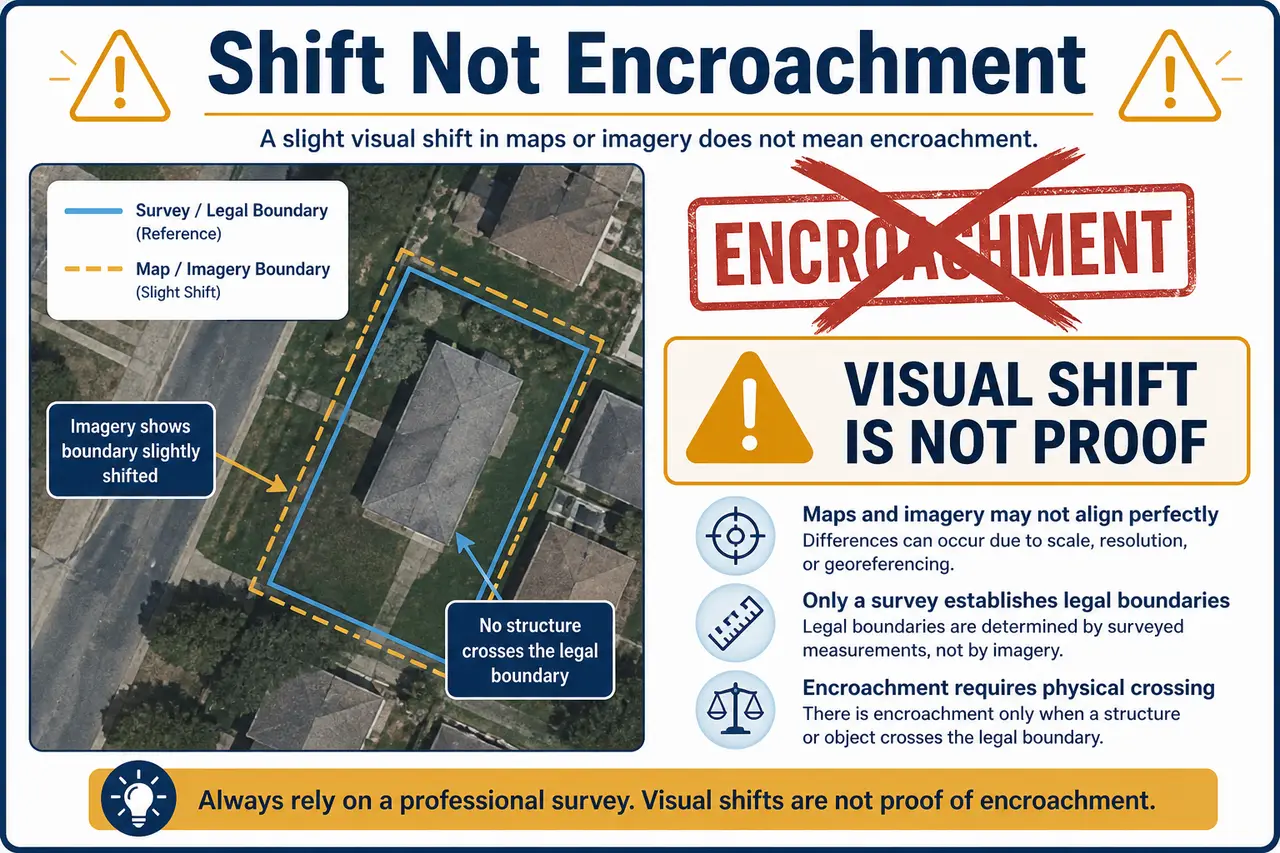
Online plot boundary vs official demarcation के अंतर के लिए Online plot boundary vs official demarcation guide पढ़ें। Serious mismatch cases में WebGIS wrong plot boundary mismatch guide भी helpful हो सकती है।
Satellite View कब Useful है?
- ✓Location context और surrounding area समझना
- ✓Roads, canal, pond और landmarks identify करना
- ✓Village layout और nearby development देखना
- ✓Basic Naksha या parcel overlay के साथ compare करना
- ✓Ground visit से पहले approximate orientation लेना
- ✓Registry description और visible features match करना
Satellite View कब पर्याप्त नहीं है?
- •Exact legal boundary
- •Ownership verification
- •Registered dimensions
- •Right of way
- •Encroachment conclusion
- •Court evidence
- •Construction permission
- •Mutation verification
Ownership और area verify करने के लिए MP Bhulekh Khasra Khatauni guide use करें।
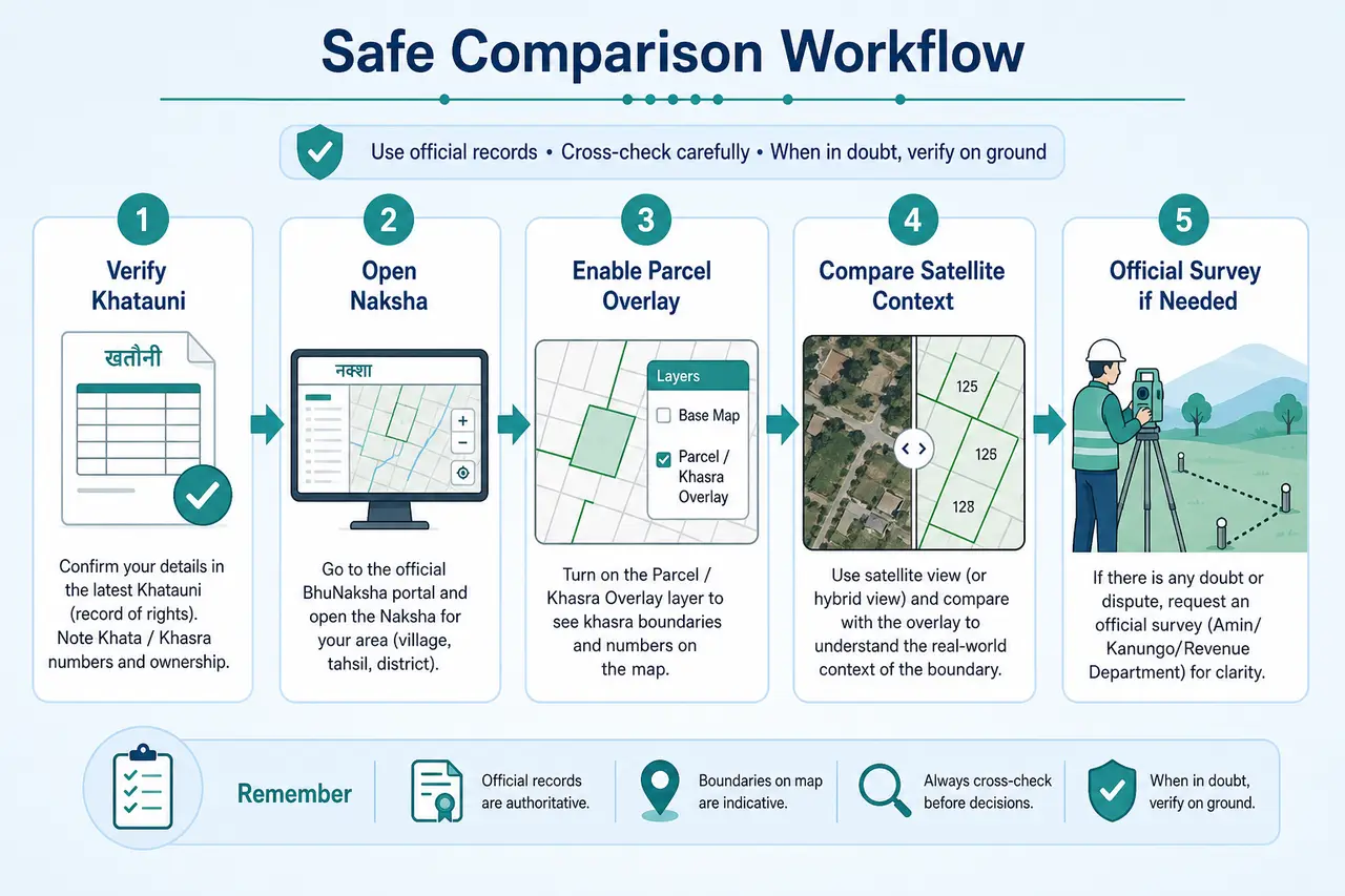
Safe Comparison Workflow
Satellite imagery और Khasra boundary compare करते समय इस क्रम से verification करें।
Current Khasra Khatauni से Number, Owner और Area verify करें।
Basic Naksha पर parcel shape देखें।
WebGIS पर parcel overlay enable करें।
Satellite base on करके roads और landmarks compare करें।
Minor alignment shift को note करें, automatic conclusion न निकालें।
Registry description और ground location compare करें।
High-value transaction या dispute में official survey लें।
Common Misinterpretations
Satellite view और Khasra overlay compare करते समय users अक्सर ये गलत assumptions बना लेते हैं।
- •Building line को legal boundary मान लेना
- •Field bund को registered सीमा मान लेना
- •Satellite image को current date का मान लेना
- •Road दिखाई देने पर legal access assume करना
- •Overlay shift को encroachment declare करना
- •Screenshot को certified evidence मान लेना
Conclusion
Satellite map location context समझने के लिए useful है, जबकि Khasra overlay parcel structure दिखाता है। दोनों का purpose अलग है। Minor visual shifts को legal dispute या encroachment का final proof न मानें; important cases में certified map और official field verification लें।
Related Guides
आगे की जानकारी के लिए ये related guides उपयोगी हो सकती हैं।
WebGIS MP Bhulekh Complete Guide
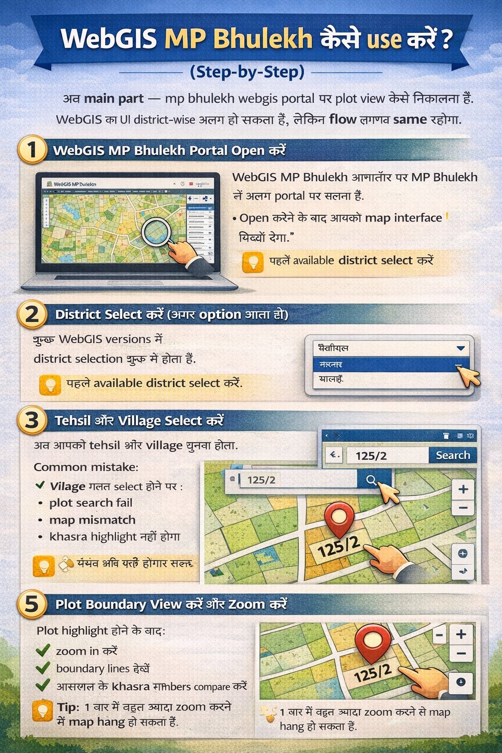
District–Tehsil–Village selection और basic Khasra search की पूरी प्रक्रिया।
Read Complete WebGIS Guide →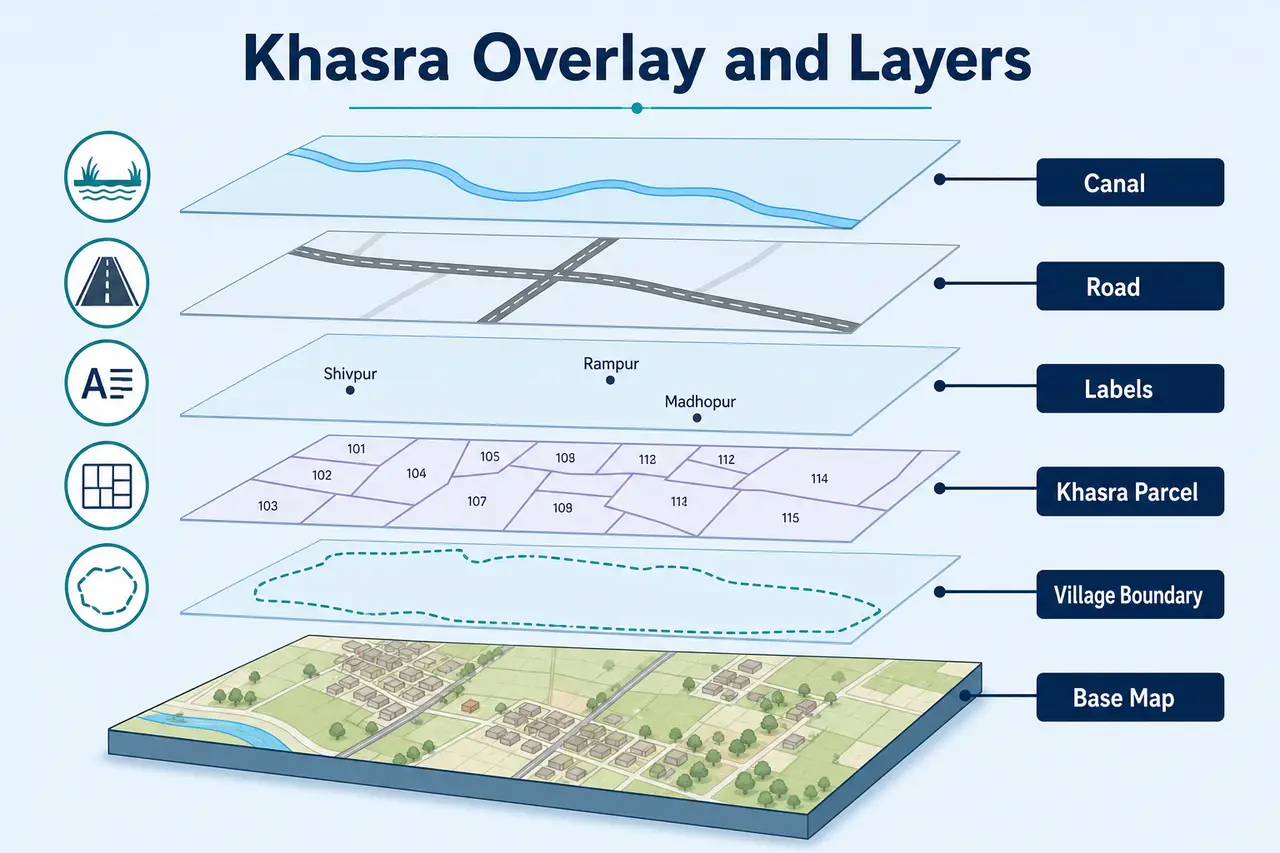
Khasra Overlay और Map Layers
Parcel overlay, satellite base और layer controls समझें।
Read Overlay Guide →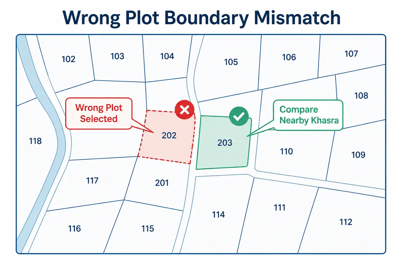
Wrong Plot और Boundary Mismatch
Map खुल रहा है लेकिन registry या ground से match नहीं कर रहा।
Check Boundary Mismatch Steps →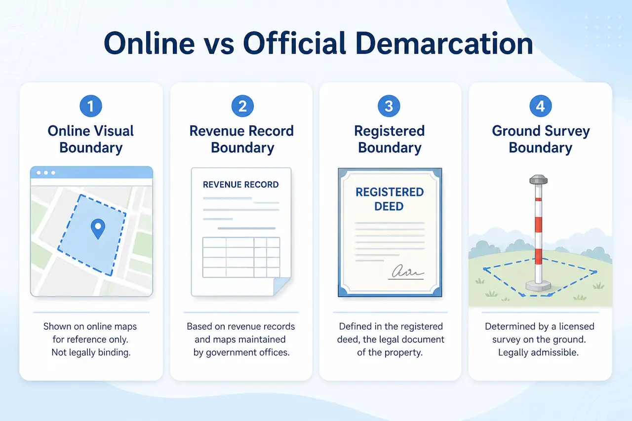
Plot Boundary Demarcation MP
Online plot boundary vs official demarcation का अंतर समझें।
Read Demarcation Guide →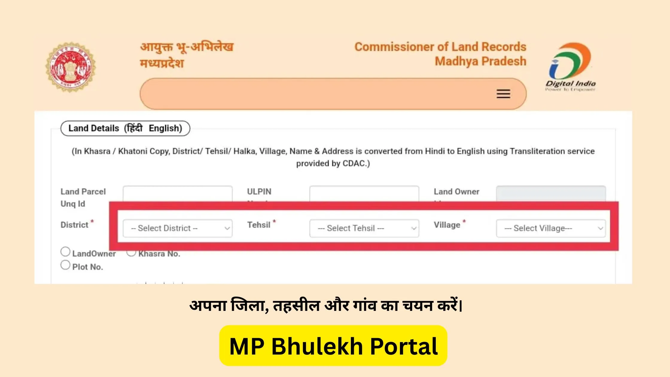
MP Bhulekh Khasra Khatauni
Owner Name, complete Khasra Number और Area verify करें।
View Khasra Guide →Frequently Asked Questions
Satellite map, Khasra boundary और alignment mismatch से जुड़े common questions
MPBhulekh.app एक स्वतंत्र informational website है और Madhya Pradesh Government, Revenue Department, MP Online या किसी official WebGIS service से affiliated नहीं है। Online maps, screenshots और browser PDFs सामान्य reference हैं; इन्हें certified ownership, title या exact boundary proof न मानें। Property transaction, dispute, survey, registry, mutation या legal use के लिए संबंधित authority और qualified professionals से current records verify करें।
Last updated: 29 July 2026