
WebGIS Map और जमीन की Boundary Match न हो तो क्या करें?
WebGIS boundary mismatch — verification और correction steps
WebGIS map load होने के बाद भी कई users को registry, Khasra record या ground fencing से mismatch दिखाई देता है। Map पर selected parcel सही लग सकता है, लेकिन Area, shape, Owner details या adjacent boundaries expected से अलग हो सकती हैं।
Mismatch का मतलब हमेशा government record error या encroachment नहीं होता। गलत Village, old Khasra Number, subdivision, pending mutation, outdated GIS layer, digitization alignment या registry interpretation भी कारण हो सकते हैं।
अगर parcel search या highlight ही काम नहीं कर रहा, तो WebGIS plot highlight problem guide देखें। यह page केवल map-record-ground mismatch verification पर focused है।
महत्वपूर्ण सूचना: MPBhulekh.app एक स्वतंत्र informational website है और Madhya Pradesh Government, Revenue Department, MP Online या किसी official WebGIS service से affiliated नहीं है। Online maps, screenshots और browser PDFs सामान्य reference हैं; इन्हें certified ownership, title या exact boundary proof न मानें। Property transaction, dispute, survey, registry, mutation या legal use के लिए संबंधित authority और qualified professionals से current records verify करें।
WebGIS Map, Registry और Ground Boundary अलग क्यों दिख सकती है?
Search Intent: User WebGIS map खोल सकता है, लेकिन Khasra record, registry या ground reality से conflict देख रहा है। Primary keyword: WebGIS boundary mismatch।
Mismatch का मतलब हमेशा government record error या encroachment नहीं होता। गलत Village, old Khasra Number, subdivision, pending mutation, outdated GIS layer, digitization alignment या registry interpretation भी कारण हो सकते हैं। इसलिए correction request से पहले structured verification जरूरी है।
अगर parcel search या highlight ही काम नहीं कर रहा, तो WebGIS plot highlight problem guide देखें।
इस Guide में क्या मिलेगा?
सीधे संबंधित section पर जाने के लिए नीचे दिए links use करें।
Mismatch के Common Types
WebGIS boundary mismatch को identify करने के लिए पहले error type समझें।
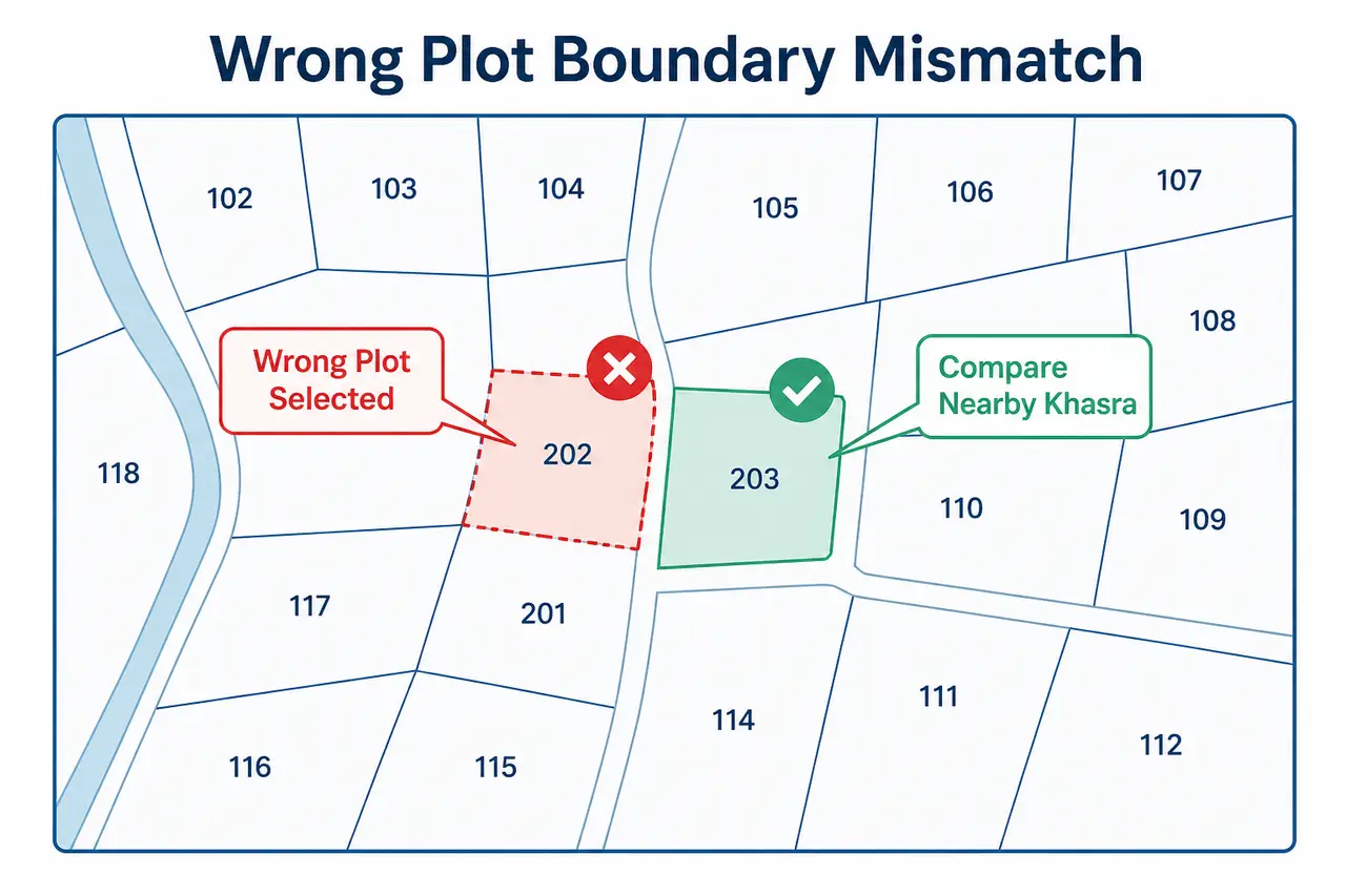
Wrong Plot Selected
Khasra search के बाद अलग parcel highlight होता है।
Area Mismatch
Khasra record का Area और registry या GIS display match नहीं करता।
Shape Mismatch
Digital parcel का shape ground fencing या document sketch से अलग है।
Boundary Shift
Satellite image पर parcel line shifted दिखती है।
Owner Record Mismatch
Map parcel सही लगता है लेकिन current Owner details अलग हैं।
Subdivision Missing
Ground या registry में parts हैं लेकिन GIS में main parcel दिखता है।
सबसे पहले क्या Verify करें?
Correction request या dispute escalation से पहले ये textual और location details क्रम से note करें।
- ✓District
- ✓Tehsil
- ✓Village और spelling
- ✓Patwari Halka, यदि available हो
- ✓Complete Khasra Number
- ✓Subdivision जैसे /1 या /2
- ✓Owner Name
- ✓Recorded Area
- ✓Registry date
- ✓Mutation status
- ✓Nearby Khasra Numbers
Mismatch के Possible Reasons
Map-record conflict के common technical और administrative causes।
Wrong Village or Similar Name
Same नाम के Village अलग Tehsil में हो सकते हैं।
Old Khasra Number
Old registry में previous survey number हो सकता है।
Subdivision or Partition
Main parcel छोटे Khasra parts में divide हुआ हो सकता है।
Mutation Pending
Ownership record update हुआ हो लेकिन map layer update pending हो।
GIS Data Outdated
Digital parcel layer current revenue change reflect न करती हो।
Digitization Alignment
Paper cadastral map को digital coordinates पर align करने से visual shift हो सकता है।
Ground Encroachment or Possession Difference
Physical use recorded boundary से अलग हो सकता है; यह official verification मांगता है।
Registry Interpretation Error
Boundary descriptions, local directions या area units गलत पढ़ी जा सकती हैं।
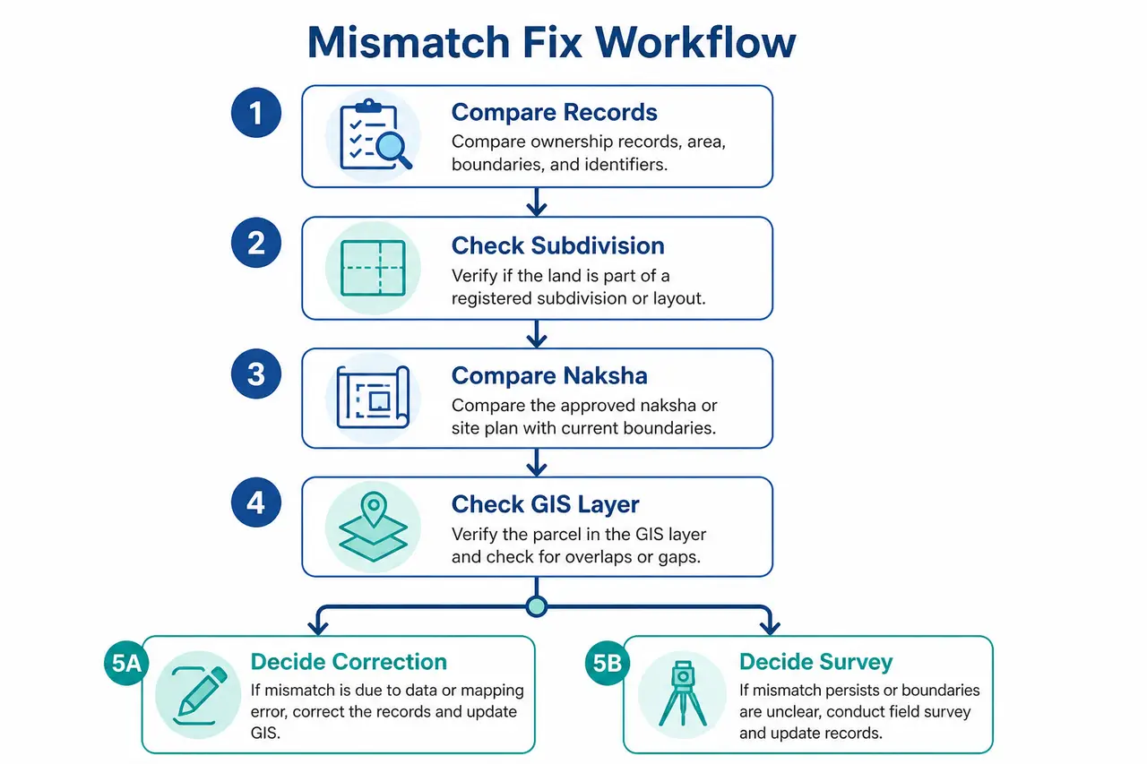
Step-by-Step Verification Process
WebGIS boundary mismatch resolve करने के लिए records, map और ground situation compare करें।
Current Khasra Khatauni डाउनलोड या view करके Number, Owner और Area note करें।
Registry में Village, Khasra Number, Area और boundary description compare करें।
Basic MP Bhulekh Naksha पर plot shape और adjacent parcels देखें।
WebGIS पर exact parcel search करें और nearby Khasra labels note करें।
Satellite layer को केवल location context के लिए use करें।
Mutation या partition records available हों तो compare करें।
Ground पर road, canal, neighboring parcel और possession verify करें।
Record error suspect हो तो official correction process की जानकारी लें।
Exact boundary issue में official survey/demarcation guidance लें।
Current record verify करने के लिए MP Bhulekh Khasra Khatauni और basic map comparison के लिए MP Bhulekh Naksha guide use करें।
Map Correction और Record Correction एक ही चीज हैं?
जरूरी नहीं। Textual land record, mutation entry, cadastral map और GIS layer अलग systems या update cycles पर हो सकते हैं। पहले identify करें कि error Owner Name में है, Area में है, Khasra Number में है, map parcel में है या केवल satellite alignment में है।
Textual record correction process के लिए MP Bhulekh record correction guide देखें।
Mutation के बाद Map Update क्यों नहीं दिखता?
Ownership mutation और spatial parcel update अलग workflows हो सकते हैं। Owner Name update होने का मतलब parcel geometry तुरंत बदलना नहीं है। इसी तरह partition या subdivision के बाद textual record और WebGIS layer update अलग समय पर दिखाई दे सकते हैं।
Mutation process समझने के लिए MP Bhulekh mutation naamantaran guide पढ़ें।
कब Official Verification जरूरी है?
निम्न situations में online map comparison के बाद official verification या survey guidance लेना sensible हो सकता है।
- •High-value purchase
- •Boundary dispute
- •Encroachment concern
- •Family partition
- •Construction or fencing
- •Court matter
- •Registry और Area का material mismatch
- •Road-access dispute
Exact boundary issue में plot boundary demarcation MP guide देखें।
Evidence Checklist
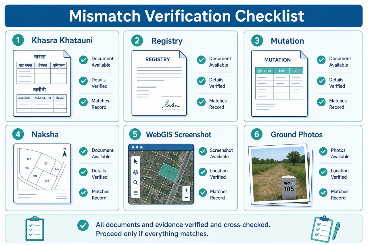
Correction request, dispute discussion या official verification से पहले ये documents और references तैयार रखें।
- ✓Current Khasra Khatauni
- ✓Registry or sale deed
- ✓Mutation record
- ✓Basic Naksha
- ✓WebGIS screenshot with date
- ✓Old land records
- ✓Certified map, if available
- ✓Ground photographs
- ✓Official application or survey record
क्या Screenshot Correction के लिए पर्याप्त है?
Screenshot issue explain करने में useful हो सकता है, लेकिन वह अपने आप certified proof नहीं होता।
Screenshot में Village, Khasra Number, visible nearby parcels और date note करें, फिर official requirements के अनुसार supporting documents तैयार करें।
Conclusion
WebGIS mismatch को solve करने का सही तरीका current textual record, registry, basic Naksha, GIS parcel और ground situation को क्रम से compare करना है। पहले error type identify करें, फिर correction या survey की जरूरत तय करें। केवल online map या screenshot के आधार पर ownership, encroachment या legal boundary का final conclusion न निकालें।
Related Guides
आगे की जानकारी के लिए ये related guides उपयोगी हो सकती हैं।
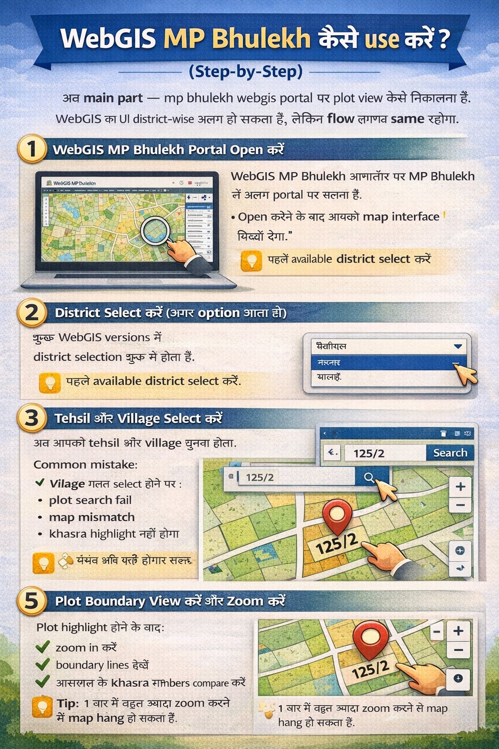
WebGIS MP Bhulekh Complete Guide
District–Tehsil–Village selection और basic Khasra search की पूरी प्रक्रिया।
Read Complete WebGIS Guide →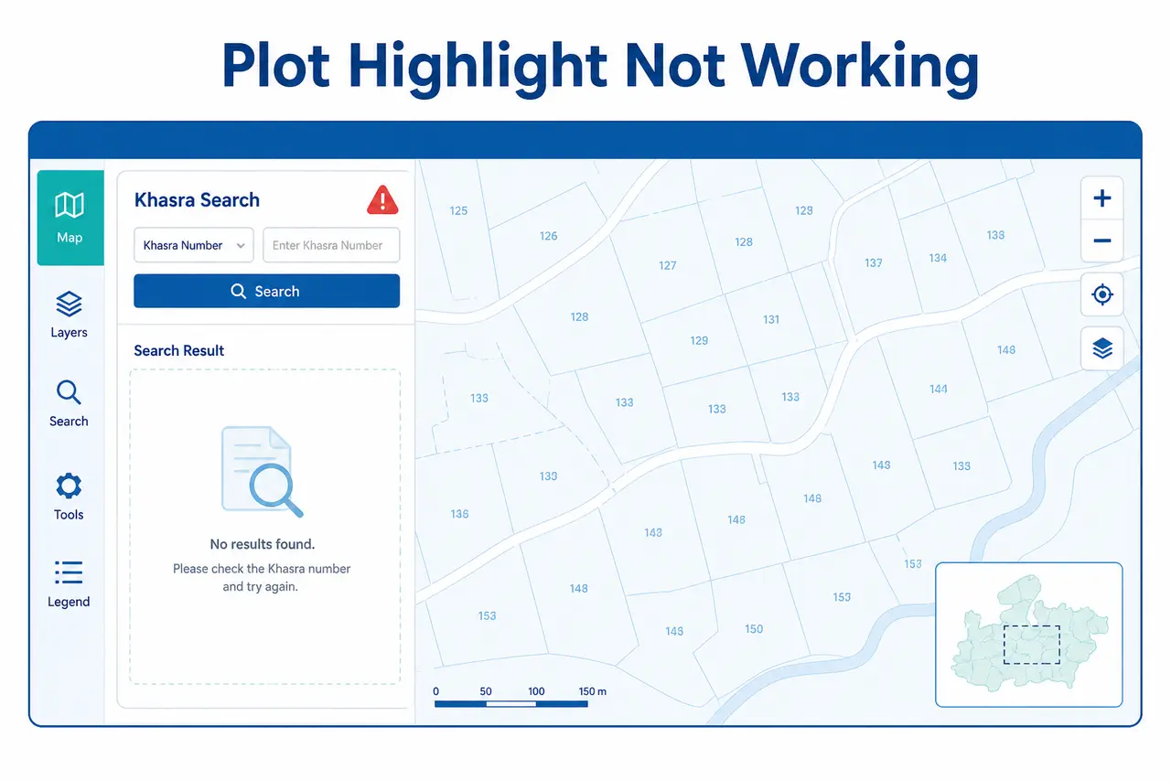
Plot Highlight Not Working
Parcel search या highlight काम नहीं कर रहा? Troubleshooting guide।
View Plot Highlight Fixes →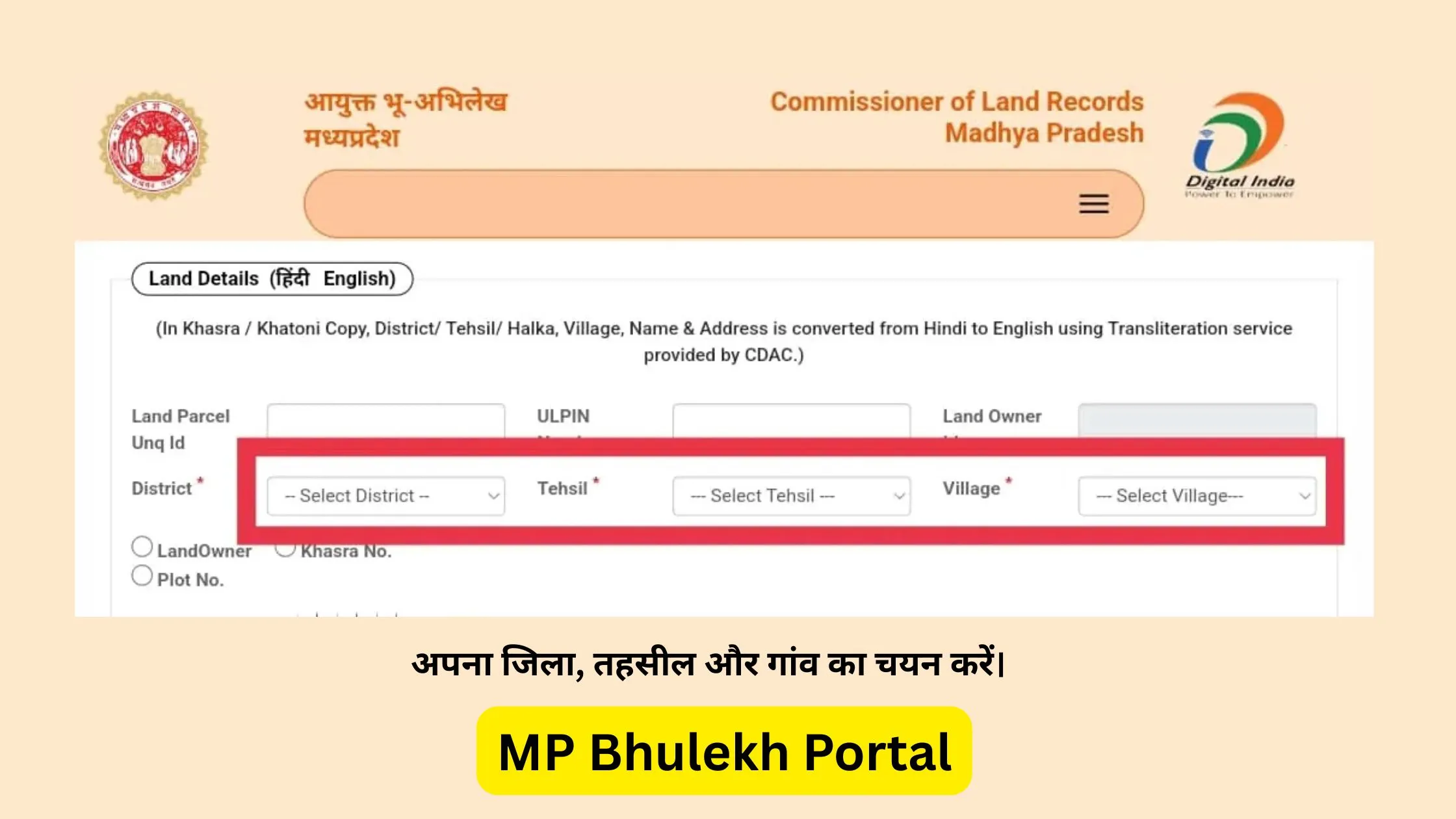
MP Bhulekh Khasra Khatauni
Owner Name, complete Khasra Number और Area verify करें।
View Khasra Guide →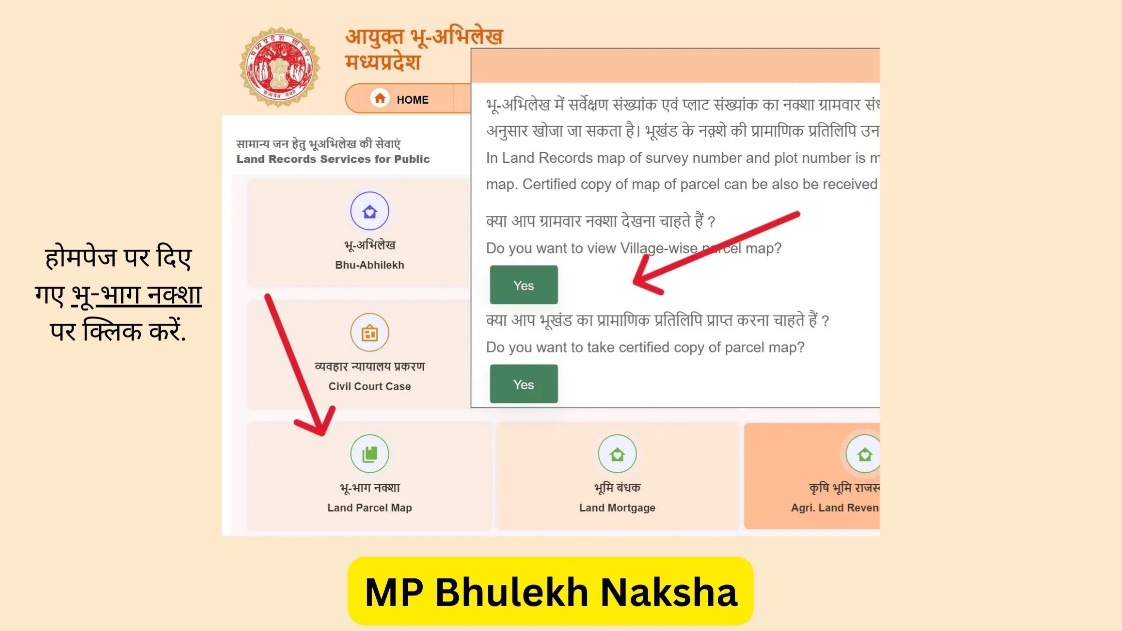
MP Bhulekh Naksha Guide
Basic Village map पर plot shape और adjacent parcels देखें।
Read Naksha Guide →Record Correction MP Bhulekh
Textual land record error correction process समझें।
Read Record Correction Guide →Plot Boundary Demarcation MP
Exact ground boundary issue में official survey guidance।
View Demarcation Guide →Frequently Asked Questions
WebGIS boundary mismatch से जुड़े common questions
MPBhulekh.app एक स्वतंत्र informational website है और Madhya Pradesh Government, Revenue Department, MP Online या किसी official WebGIS service से affiliated नहीं है। Online maps, screenshots और browser PDFs सामान्य reference हैं; इन्हें certified ownership, title या exact boundary proof न मानें। Property transaction, dispute, survey, registry, mutation या legal use के लिए संबंधित authority और qualified professionals से current records verify करें।
Last updated: 29 July 2026